Tuesday, November 27, 2007

Nine Very Different Islands - Azores Islands

The Azores (Portuguese: Açores) are a Portuguese archipelago in the Atlantic Ocean, about 1,500 km (950 mi) from Lisbon and about 3,900 km (2,400 mi) from the east coast of North America. The westernmost island (Flores) actually lies on the North American plate and is only 1,925 km (1,200 mi) from St. John's in the Canadian province of Newfoundland and Labrador.


The islands are, geologically speaking, young. The youngest, Pico, is only 200,000 years old and the other eight originated 1 to 5 million years ago.

The nine major Azorean Islands and the eight small Formigas extend for more than 600 km, and lie in a north west-south east direction. The vast extension of the islands defines an immense exclusive economic zone of 1.1 million km². The westernmost point of this area is 3,380 km from the North American continent.


All of the islands have volcanic origins, though Santa Maria also has some reef contribution. The mountain of Pico on Pico Island, at 2,351 m in altitude, is the highest in all of Portugal. The Azores are actually the tops of some of the tallest mountains on the planet, as measured from their base at the bottom of the ocean. The archipelago forms the Autonomous Region of Azores, one of the two autonomous regions of Portugal.

Though it is commonly said that the archipelago is named after the goshawk (Açor in Portuguese), because it was supposed to be a common bird at the time of the discovery. Some historians indicate the archaic Portuguese word "azures" (the plural of blue) because of the colour of the islands when seen from afar. Most, however, insist that the name is derived from birds, pointing to a local subspecies of the buzzard (Buteo buteo), as the animal the first explorers erroneously identified as goshawks.


The location, almost in the middle of the Atlantic, has a determining influence on the weather which can vary greatly from island to island. What is more, each island has its own character – that’s what makes traveling and hiking in the Azores so interesting.


Saturday, November 17, 2007

The Islands history - Azores


The existence of this archipelago was not generally known to the inhabitants of Europe before the fifteenth century of our era, although there is evidence that Phoenician, Scandinavian, and Arabian navigators visited it at different periods.

Heinrich the Seafarer Infante Dom Henrique, the second son of the Portuguese king Joao I, wanted to investigate the rumours concerning unknown islands in the Atlantic. Various Italian maps of the 14th century showed islands in the Atlantic. The Italian Pizigano drew a map of the Atlantic in 1367 with an indication at the place where Corvo lies. But there was no concrete evidence. In 1427, commissioned by Heinrich the Seafarer, Captain Diogo de Silves discovered the island of Santa Maria, and by the year 1457 all the islands had been visited by either Portuguese or Flemish explorers, none of whom found any aboriginal inhabitants, wild animals, or reptiles.


In between 1439 to 1444 came the first population to Sao Miguel that disembarked in Povoação. They came mainly from "Estremadura", "Algarve", "Alto Alentejo" and, then later from foreign countries, specially from France (explanation why Bretanha, a village on the North-West coast, is named that way).

Being a fertile island, with good climate and situated in the middle of the Atlantic Ocean helped to produce wheat to export to North Africa; sugar-cane and dyes to Flanders, and helped to strengthen the economic expansion of the island.

In 1466 Afonso V of Portugal granted to the Duchess Isabel of Burgundy, his aunt, some sort of feudal privilege in the Azores, in consequence of which the colonists for some time were mostly Flemings, and the Portuguese themselves in those days called the islands As Ilhas Flamengas (the Flemish Islands).

The first capital of Sao Miguel was "Vila Franca do Campo", but, unfortunately, the development and prosperity didn't last too long, because, in 1522, a violent earthquake destroyed completely the capital, and approximately 5000 people died. After that, "Ponta Delgada", located 25 kilometres west of "Vila Franca" and already the centre of the municipality, became the first city and capital of the island in 1546.

In 1583, Philip II of Spain as king of Portugal, sent his combined Iberian fleet to clear the French traders from the Azores, decisively hanging his prisoners-of-war from the yardarms and contributing to the "Black Legend". The Azores were the second-to-last part of the Portuguese empire to resist Philip's reign over Portugal (Macau being the last), Azores was returned to Portuguese control with the end of the Iberian Union, not by the military efforts, as these were already in Restauration war efforts in the mainland, but by the people attacking a well-fortified Castillian guarnition. There is also evidence that a significant number of seafarers from India, working for Portuguese merchant ships also settled in the Azores.

Goshawk (Açor in Portuguese), the islands name.

The commercial prosperity of the islands declined after the recovery of Portuguese independence and the accession of the House of Braganza in 1640. The city of Angra attained some slight historical notoriety in 1662, when Affonso VI, deposed by his brother Dom Pedro, was imprisoned there. Material prosperity began to be restored to the Azores immediately after the period of the French invasion of the Peninsula and the flight of João IV to Brazil (1807), when the former restrictions of commerce were removed.

In the Portuguese revolution of 1828-33, the Azorean populations took a decided stand against the absolutist Dom Miguel, repulsed an attack upon the island of Terceira by a Miguelist fleet, and contributed largely to form the Progressista army which landed at Oporto in 1833, driving Dom Miguel into exile, and establishing on the throne the Queen Donna Maria da Gloria, who for two years preceding had resided at Angra.

In 1829, in Vila da Praia, the liberals won over the absolutists, making Terceira Island the main headquarters of the new Portuguese regime and also where the Council of Regency (Conselho de Regência) of Mary II of Portugal was established.

Beginning in 1868, Portugal issued its stamps overprinted with "AÇORES" for use in the islands. Between 1892 and 1906, it also issued separate stamps for the three administrative districts of the time.

From 1938 to 1978, the archipelago was divided into three districts, quite equivalent (except in area) to those in the Portuguese mainland. The division was quite arbitrary, and didn’t follow the natural island groups, rather reflecting the location of each district capital on the three main cities (neither of each on the western group).


Angra consisted of Terceira, São Jorge, and Graciosa, with the capital at Angra do Heroísmo on Terceira.
Horta consisted of Pico, Faial, Flores, and Corvo, with the capital at Horta on Faial.
Ponta Delgada consisted of São Miguel and Santa Maria, with the capital at Ponta Delgada on São Miguel.

In 1976 the Azores became an Autonomous Region (Região Autónoma dos Açores) and the Azorean districts were suppressed.

The capital of the Azores - Ponta Delgada

Ponta Delgada is the capital of the Azores archipelago as well as the capital of its largest island, São Miguel. Ponta Delgada is a flat town situated on the south coast of São Miguel and lies in a wide bay between green hills. The city is considered the tourist heart of Azores with a population of over 65,000. It is used by many as a base for exploring Sao Miguel and Azores’ other islands. But Ponta Delgada itself has a lot to offer – its magnificent renaissance architecture, its rich museums, the nearby natural attractions, and the city’s vibrant festivities and nightlife.


Ponta Delgada began as a fishing village. Its safe inlets and great location on the south coast turned it into the main port of Sao Miguel in the 16th century. After suffering attacks in the 16th and 17th centuries, Pont Delgada experienced economic prosperity during the 18th and 19th centuries, which led to the construction of grand palaces, churches, mansions, and monuments that now adorn the city’s skyline.
In 1861, Ponta Delgada began building an artificial port, which further cemented the city’s status as the main port and economic and administrative center of the Azores.

The airport lies on the western edge of the city, from which there are daily flights to the other islands and mainland Portugal, and frequent direct flights to other European cities and North America.

Ponta Delgada is a great place to start out your travels in and around the Azores. It is possible to make day tours from the city to volcanic crater lakes and thermal springs in the central regions of the island. The Caldeiras of Sete Cidades, an extinct volcano with two adjoining crater lakes, is just a short drive northwest of the city. The thermal springs, health baths, and spa resorts of Furnas Valley are to the city’s east and within driving distance.

Ponta Delgada itself, however, boasts an impressive array of architectural riches: from churches, mansions, palaces, and convents, to various statues and monuments. The city welcomes you with the “Portas da Cidade” gates, constructed in the form of three arches.


The three churches, St. Sebastian’s (São Sebastião), St. Joseph’s (São José), St. Peter’s (São Pedro) are marvels, each representing a different architectural era.

The St. Sebastian’s was completed in 1547 and is gothic in structure, Manueline in exterior, and adorned in the interior with gold thread embroideries and rare Brazilian wood. The St. Joseph’s was completed in 1709 and is more hispano-mexican, built using Jacarandá wood and decorated with religious statues and sculptures in baroque style. The St. Peter’s is more an 18th century church but the famous painting of “Pentecostes” by Pedro Carvalho is found at this church.

Besides churches, there are palaces like the Fonte Bela, Sant’Ana and the Santa Catarina (residence of the Governor during the 18th century), and government buildings like the “Paços do Concelho” City Hall.
The Convent and Chapel of Our Lady of Hope, “Nossa Senhora de Esperança” generally known as “Convento de Esperança” or simply Saint Christ’s Church “Igreja do Santo Cristo”, is home to the magnificent statue of “Senhor Santo Cristo dos Milagres” Christ of Miracles, the patron of the largest religious festival place in the Azores.


There are many other buildings throughout the city which portray the urban architecture from the 17th to the 19th centuries. Wandering through the streets to discovering both the curious and the beautiful is a favourite pastime of all visitors.

One of the important business centres is located on the Avenida Marginal, the avenue which follows the coastline of Ponta Delgada. The entrance to the Port where all the maritime traffic docks on the island is located at the extreme west end of the avenue. During the day traffic along the avenue is constant and on hot summer nights it becomes a popular meeting place.


Located north of Ponta Delgada are the suburbs of Fajã de Baixo and Fajã de Cima. Fajã de Baixo is agricultural with pineapple cultivation. Fajã de Cima is famous for its festivities. To the eastern side of Ponta Delgada is the suburb of "São Roque" which is gradually becoming part of the city itself as it expands along the coast with the construction of a new marina and a seaside walk with leisure facilities.

Ponta Delgada also has a university, the Universidade dos Açores (University of Azores), as well as schools, lyceums, gymnasia, banks, post offices, sporting facilities, three major soccer teams and several public squares (praças).

Thursday, November 15, 2007

The good weather island history - Santa Maria

Santa Maria, the eastern island of the Azores, is geologically unique brothers and sisters – it is supposed to have risen out of the sea 160 million years ago, in the Jurassic period. There are no volcanic eruptions, no earthquakes. 17km long and 9.5km wide, it is one of the small ones. Flat in the west, mountainous in the east, and the highest mountain, Pico Alto, is only 587m high, nevertheless an ideal viewpoint over to Sao Miguel.


Santa Maria is ideal for island lovers: people who love white beaches, spend their day at leisure, walk and don’t expect anything special to happen. You fly to the island on a small SATA plane. There’s a ferry connection planned with Sao Miguel, but that would also encourage more tourists.

Diogo de Silves is said to have discovered the island in 1427 on the saint’s day of the Virgin which gave it the name of Santa Maria. In 1439 the Portuguese Gongalo Velho Cabral came to take up post as captain of the island with a ship which was loaded with settlers and seeds. The settlers came from the Algarve coast which you can still see today in the construction of the houses. They founded Santana, Anjos, Praia and, as a harbour, Vila.


In 1493 on his return from the Caribbean islands Columbus anchored offshore from Anjos to pray and to stock up with provisions. There are various stories about his arrival. At first they thought he was a pirate, until his identity could be proved after a lot of toing and froing. He prayed in the old church of Anjos of which today only the archway remains, and in the year of Columbus, 1993, the islanders erected a memorial in his honour. For centuries the settlers had problems with pirates, evidence of which is the fort outside Vila do Porto armed with canons. The attacks by pirates resulted in more and more settlers immigrating to Brazil. People lived from the cultivation of woad, which produces a blue dye, and a lichen (orchil) which gives a very good brown dye. Up to the 17th century the blue colours were sold to Flanders, England and Spain but they were displaced by the indigo from Brazil. Brown remained in demand until chemical dyes came onto the market in the 19th century. The settlers worked for about 16 big landowners until the island was divided up in 1590 and each family received a piece of land.


Today there are 6000 inhabitants of which 2800 live in Vila do Porto. During the second World War circumstances changed when the Allies received authorization for the building of two airport bases. A 3km long runway was built on Santa Maria for trans-Atlantic flight changeovers which is no longer necessary today. But the airport is still the largest income provider of the island with 500 employees who have made their homes around the airport. At present it’s chiefly the Holy Spirit charter planes which land here at the time of the festival, from Boston and Toronto with Azorean emigrants who have remained in contact with their homeland. Many of those who returned to Santa Maria have built themselves a little house with a garden for growing vegetables and keeping pigs and have retired there.


The agricultural Santa Maria has a lot going for it – reliable weather, the shops in Vila do Porto’s main street where you can buy everything you need, and the short distance from Sao Miguel and Ponta Delgada for times when bigger shopping expeditions need to be made, you have to go on important business or you simply want to take part in the festivities in Ponta Delgada. Two hotels, one at the airport and one in Vila do Porto, offer accommodation, as well as Apartementos Turisticos at the Praia Formosa near Vila do Porto, with favourable prices and recommended if you are wanting to stay a little longer on Santa Maria.

The tourist office managed only by a single person (Posto de Turismo) is situated in the airport. The beautiful white beaches on this island of good weather are inviting places to sunbathe, but the intensity of the sun’s rays make the use of effective sun-cream absolutely imperative.

Wednesday, November 14, 2007

The Green Island - São Miguel

São Miguel is the largest and most populated of the Azores Islands; 60% of the archipelago’s residents in fact live on São Miguel. The island is part of the eastern group of the Azores archipelago. Nicknamed “the Green Island”, much of São Miguel is a land of green grazing plains, but the landscaped is also painted with high mountain peaks, rough cliffs, rolling hills, streaming waterfalls, beautiful lakes, sandy beaches, lagoon waters, and unique Laurisilva forests of evergreen hardwoods, exotic ferns and orchids.


São Miguel was first inhabited by a Portuguese settlement in 1444 after it was discovered by Henry the Navigator. Interestingly, São Miguel was originally two islands, but a volcanic eruption in 1563 joined the two islands together. In the 16th and 17th century, the island was the subject of several attacks by France, England, and Algeria. It was conquered by Spanish forces in 1582 but became Portuguese in 1640 after Portugal restored its independence. Some scholars like Strabo and Plutarch, based on geology and history, believe São Miguel is the mythical island of Ogygia mentioned in Homer’s Odyssey. Ogygia in Homer’s epic tale is the home of the nymph Calypso who detained Odysseus for seven years and kept him from returning to his home of Ithaca, Greece.

Ponta Delgada is the capital of this autonomic region housing the University of the Azores. The city is protected by a long strip of land or port and lies between the mountains and the sea. The whole city is made from the black porous volcanic rock; buildings, the pepple stones of the streets and the sidewalks. As in all cities, you can find the Se or church in the town square. But the most interesting is the Museum of Carlos Machado in the Convent of Saint Andrew. This 17th to 18th c. museum has a nice collection of paintings, etchings and zoological findings. Ponta Delgada also has the airport nearby for easy access to the island.


Today, São Miguel offers a wealth of attractions for tourists; at the forefront are its natural landscapes. The island is full of hiking trails in, around, and through its lakes, beaches, and middle highlands, the latter being home to the island’s many caldeiras, hot springs, geysers, thermal baths, and volcanic craters and cones that can be visited or explored.


The Furnas Valley is one of São Miguel’s natural hot spots, the location of the award-winning Terra Nostra Park. This park is the most beautiful in São Miguel and is groomed with lakes, streams, ponds, exotic flowers, primeval trees, and thermal spring lakes. The island is full of volcanic craters and cones as well like the Caldeiras in the Furnas Valley, the crater of an extinct volcano at Lagoa do Fogo Lake, and the 12 kilometer crater found at Sete Cidades Lake. The Caldeiras at Furnas Valley, in particular, are famous for being a natural kitchen; it is a tradition among the residents to bury pots of food in the earth to create specialty dishes like the “cozido” or the “caldeiradas de peixe” (fish bouillabaisse).

The Pico do Carvao and the Tronqueira are not to be forgotten. Both are mountain peaks that are near lakes, surrounded by forests of trees, and perfectly located for great seascape and vista views below of the coast and island. The latter, Tronqueira, has the highest point on the island, Pico de Vara, at 3,545 feet.

The beaches of São Miguel are also charming and most of them nestled among cliffs with natural swimming pools between rock shelters. Most of the beaches are located on the eastern edge of the island.

Tuesday, November 13, 2007

Tea Factory and Plantation - Gorreana Tea


Tea, now enjoyed daily by millions of people throughout the world, is one of the oldest beverages in civilization. It was first used as a drink around the third century BC.

See Many legends surround the discovery of this soothing potion. It certainly was used in religious rites, rituals, and as a medicine (my grandma thought it was the cure for everything).

Native to China, it was prepared according to the period. The Tang Dynasty (620-907) boiled it, the Song Dynasty (960-1276) whisked it, and the Ming Dynasty (1368-1644) infused it. By the fourteenth century, Japan began cultivating it and using it in many tea rituals, as they continue to do today.

In the 1800s, tea bushes were brought from Portuguese Macao to the Island of the Azores. In 1878, two skilled tea masters, Lau-A- Pan and Lau-A Teng, arrived in São Miguel to oversee production, and the bushes thrived. Gorreana was established in 1883.


As I approached the property, I passed rows and rows of well-trimmed bushes. Terraces of green sparkled in the sunlight, making for a picturesque pastoral scene.


Gorreana produces only green and black tea (Orange Pekoe) using age-old methods. Despite this being a popular tourist stop, I had the place to myself. Because I arrived around lunchtime, the machinery was idle. I would have liked to see the antiquated machines in operation. One machine had a beautiful copper plate, proclaiming that the British India Tea Company made it in the 1800s.


No one spoke English, but a tour guide is available by appointment. I just wandered around and found the whole place fascinating. The pungent odor of the plants was not unpleasant. At the end of the tour (arrows on the wall point the directions step-by-step), we sat and helped ourselves to tea and cookies.
The tea was good, despite it not being in a china cup. I bought a few boxes of tea from the little kiosk. Workers were milling around -- happy, smiling people who seemed content in their work. I did note that the majority of the workers were women. There is no charge for the tour, and from the testimonials pasted across the kiosk, this place is a popular tourist spot.

Monday, November 12, 2007

One day inside the crater - Furnas

Today I will talk about how you can spend one day in a small village inside the crater of a volcano with geotermic activity. Furnas is a stratovolcano with two calderas which date back to approximately 30,000 years ago. The second approximately dates back to 20,000 years ago.

The western of the two calderas is partially filled by a crater lake, Lagoa das Furnas, at an elevation of 359 m (1,181 ft). Fumaroles and mud sands are located at the northern part of the lake.

Furnas is a parish in the district of Povoação in the Azores. The population in 2001 was 1,541, its density is 45.5/km² and the area is 33.88 km². The parish is one of the largest in the island and in the Azores. It is located east of Lagoa and Ponta Delgada, west of Povoação and southeast of Ribeira Grande.


The mountains are to the north with several valleys including one to the north-northwest. Most of the mountains are forested while grasslands are found at higher elevations.

Furnas will take you all day if you want, because there is a lot to do. You can star by going to the Caldeiras next to the Lake, where the tradition is to cook "cozido" in a hole in the ground. You can watch how it is done, even today people do it (despite the fact that they can also do it at home in the hoven) because the taste is different.


After that you can walk (carefully) around the bubling hot natural jacuzzis and enjoy the natural beauty of the surronding environment.


After that, you can go to the village and see the garden of Terra Nostra (astonishing botanic park) and take a long bath in the pool with the yellow warm water (heaten up by the geotermic activity) - when you overcome the fact that the water looks like mud you will want to stay inside the pool for hours!


After that, yoo will be really satisfied with the day you spent in Furnas.

Sunday, November 11, 2007

A trail with a waterfall - Faial da Terra – Salto do Prego - Sanguinho


Today i will describe a beautiful trail that I met recently in Faial da Terra.


Faial da Terra is a parish in the district of Povoação on São Miguel Island in the Azores. The population in 2001 is 377, its density is 29.7/km² and the area is 12.69 km². It is located in the southeastern part of the island. The main industry are agriculture.
It is connected with a road linking Ponta Delgada and Povoação. The road to Ribeira Grande is about 1 km E. The Atlantic Ocean is to the south. The mountains are to the north. Faial da Terra are the smallest in density and one of the lowest parishes in Povoação.


This trail starts and ends at "Faial da Terra" locality and has the total duration of one hour and a half. Firstly, it follows close to the stream margin, which maintains water all year long and from where the trail only moves away by a strong inclination track, to the point of the first bifurcation.

At this time, one should proceed to "Salto do Prego", a beautiful waterfall where pittosporum and acacia predominate.


Baths at the waterfall are not wise due to the possibility of trees falling down.
Turn back by the same way until arriving to the same bifurcation, where now one should turn right to "Sanguinho" small village.


This place, that has about twenty houses in recovery process, it's so called for, as far as known, the strong presence of an endemic plant to Madeira and Azores of that name: "sanguinho".


After "Sanguinho" village, the trail progresses by a descent until arriving again to "Faial da Terra" locality.


It is asked to the trailers not to catch fruit at any part of the trail.

Mosteiros - Monastery

Today i will talk about the small village Mosteiros, that is located in the district of Ponta Delgada in São Miguel Island and the population in 2001 is 1,196, its density is 133.2/km² and the area is 8.98 km². It is located in the northwestern part of the island of São Miguel and is connected by roads to Ponta Delgada in the south and Ribeira Grande in the east. The mountains which are covered with lovely trees are to the east and a mountain range is situated in the southeast about 1 km away from the Atlantic Ocean.


The village is aligned from north to south with the major road link to Ponta Delgada and Ribeira Grande. The main agricultural production are cattle with some fruits and vegetables and some farmings. It is fenced with grass that is colored golden brown. The Another village with a cape lies to the southwest. Another cape is to the north and has farms. The coastline of the parish is surrounded by rocks elevating up to 20 m.


There are two small islets to the northwest and three in the southwest including a large one further west and two smaller ones slightly east of the large islet. The word Mosteiros actually means monastery in the Portuguese language and the parish was named as such because the largest of these islets is shaped like a church.


Mosteiros has a school, a lyceum and a square (praça).

Thursday, November 8, 2007

Sete Cidades - Seven Cities

Today I will talk about Sete Cidades - Seven Cities, one of the most beautiful natural settings in the Azores Islands.
This natural beauty is composed of two lakes in the center of a volcanic crater about three miles across. Located on the west side of São Miguel Island, it is the most popular national park in the islands. The direction of the lake as of the photo runs from northeast to southwest and is 5 km in length and about 1 to 2 km in width. This volcano is one of the most active in the Azores in the last 5,000 years.

Looking from the edge of the crater to the lakes some 500 m (1,500 ft) below, one lake looks blue (reflecting the sky) and is called Lagoa Azul and the other appears green (reflecting the ground) and is named Lagoa Verde. According to a legend, the differently coloured lakes were created when a princess and her lover, a young shepherd, had to partfrom each other. The tears they shed at their farewell became the two lakes, with the water coloured like their eyes.


The two caldera lakes are one of the scenic highlights of the Azores. Since the first eruption about 20,000 years ago, 20 post-caldera eruptions have formed the 500 meters deep caldera walls. At the floor of the caldera six Holocene pyroclastic cones are located. A large group of pleistocene post-caldera trachytic lava domes, lava flows, and pyroclastic-flow deposits is found on the western-to-northern flanks. The most recent eruptions date to the 15th century. These eruptions occurred within the caldera and from submarine vents at the west coast of the island. There have been 4 Strombolian eruptions and 3 Surtseyan eruptions in history within a short distance of the shoreline.


The parish area is rectangular stretching from north to south. Farmlands of mainly pasture production are on the west and east with a forest in the middle. Piney forests cover the rest ot the area. One exception is near the farmlands in the west and along the central part of the lakes with a few forests except-for a tiny peninsula and along the bridge. A bridge is near the middle of the lake which provides access to the northwestern part of the island including Mosteiros. The parish is also accessible by an unlighted pedestrian tunnel through the crater. A small grassy area is to the southcentral portion of the shoreline and is surrounded by pine trees. There is another road connecting to the southwestern part of the island including Ponta Delgada.


Sete Cidades has a school, a church and a small square. The population in 2001 is 858, its density is 44.6/km² and the area is 19.22 km² mainly covering around the lake and the mountains near Sete Cidades. It is the smallest parish in population and the largest in area in Ponta Delgada.

There are mountaintops and hilltops including in the southwest, three west of Sete Cidades and around the lake.

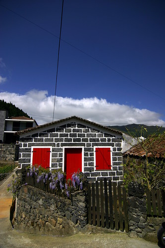
Açores - Azores - São Miguel - Furnas

Açores - Azores - São Miguel - Furnas , originally uploaded by Luis Miguens .